
Social housing providers must have a proactive, portfolio-wide plan in place to identify and mitigate extreme heat risks by 30 November 2026, as the second phase of Awaab’s Law officially extends the scope of legal hazards to include significant excess heat.
The landmark legislation, introduced after the tragic death of two-year-old Awaab Ishak, mandates social landlords to address hazards within strict, defined timescales.
While Phase 1, launched in October 2025, focused on damp, mould and emergency hazards, Phase 2 brings significant excess heat and cold directly into the regulatory spotlight.
Landlords can no longer treat overheating as a reactive complaint or a distant climate change consideration; it must now be central to immediate, portfolio-wide hazard risk management.
North West social housing group Regenda Homes, which manages around 13,000 properties, is the first housing association to successfully trial a pioneering geospatial screening model in collaboration with GIS data experts at ODCGIS and Map Impact.
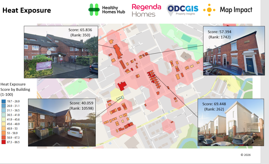
It combines high-resolution environmental heat mapping with property-level data from Ordnance Survey’s National Geographic Database (NGD) to rank and score individual homes for overheating susceptibility.
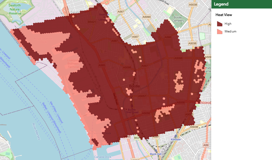
The heat mapping is contained in HeatView, Map Impact’s environmental assessment data product available via the ODCGIS Property Insights analysis data portfolio.
HeatView analyses Earth Observation datasets including Landsat land-surface temperature, MODIS temperature variation and Sentinel-2 vegetation data to provide a heat stress susceptibility score every 50 metres.
When blended with EPC certificate information and NGD data, which details property-specific features such as building age, ceiling elevation, construction type and glazing, the system generates a 0-to-100 overheating exposure score, alongside a portfolio priority rank and a data completeness score for every individual home.
This proactive approach is set to allow Regenda and fellow housing associations to move away from reactive, spreadsheet-based management and instead target preventative actions – such as shading, ventilation reviews, retrofits and tailored tenant communications – where they are needed most.
Rick Thompson, Operations Director at ODCGIS, said: “The move to include significant excess heat within Awaab’s Law is a transformational shift for social housing. Landlords need to understand not only where problems have already been reported, but also how environmental conditions and the characteristics of their buildings may combine to create potential risk. A HeatView-led analysis can provide the evidence base for answering that question across their stock. We urge social landlords looking to secure their portfolios ahead of the second phase of Awaab’s Law to act immediately.”
This was echoed by Richard Flemmings, Chief Executive of Map Impact, who said: “With the 30 November deadline here, the question is no longer whether housing stock is exposed to extreme heat, but exactly where the greatest risks lie. By delivering high-resolution satellite and environmental data directly into property screening models, we are giving landlords a transparent, practical tool to support their obligations under Awaab’s Law and protect vulnerable residents before another heatwave hits like the ones we experienced repeatedly in summer 2026.”
Presenting at this year’s ODCGIS Social Housing Seminar in Birmingham in October 2026, Shaun Minton, Asset Strategy Project Lead at Regenda, said: “The process of combining HeatView data and Ordnance Survey NGD data enabled us to rank all our properties for their susceptibility to extreme heat, allowing us to focus on the ones most in need of action. Just because a property has an EPC Level C or above doesn’t mean there isn’t a risk of overheating, leaving a big risk of missing properties out on retrofit programmes. With GIS, we can be more proactive and try to deal with issues before they become an actual hazard.”
For more information on how to implement portfolio-wide heat-risk scoring or to learn more about ODCGIS Property Insights and HeatView data, visit www.odc.co.uk or www.mapimpact.io.