ODCGIS attend the Housing Finance Conference every year due to the level of interest amongst Finance Directors, Managers, Procurement Officers and the potential cost savings GIS Mapping offers. These are some of the more obvious areas where GIS makes tangible cost savings.
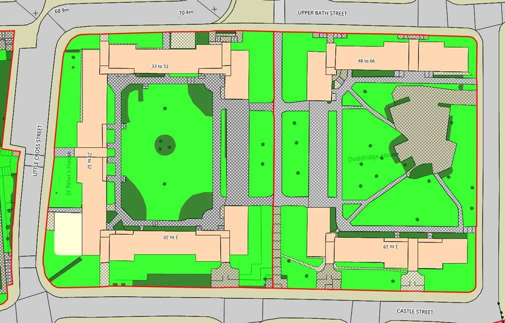
Savings generally average between 10% and 15% on Grounds Maintenance Contracts when they come up for renewal. Historically working from paper plans involved a lot of assumptions in calculating the amount of land to be maintained. GIS gives you accurate data, clearly identified on maps giving the contractor confidence not to add a contingency.
With the grounds maintenance data captured in a GIS, a Bill of Quantities can be supplied for the area or broken down for each site to help with justifying service charges.
If any of your properties are affected by electricity pylons or cables then you could potentially claim a significant amount in compensation. ODCGIS use GIS to identify potential claims and will negotiate on your behalf for the best deal.
Using GIS to produce a letting profile will help to let a property and potentially reduce the number of offers which lead to nothing. Illustrating things like school catchment and local services can make a big difference to the information you provide.
Having this additional information available at the outset can reduce the number of blind bids on properties which of course wastes your officers time in the letting process.
Conducting a patch demand analysis can help you to achieve patches that reduce travel and increase productivity as well as making them more fairly spread for your officers. This can be for Arrears officer patched, repairs patches or Housing officer patches where we analyse historic demand and geography to output the most efficient patches for your operations.
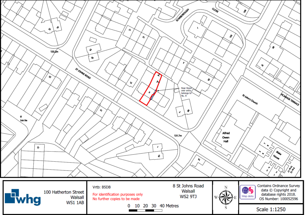
Tenants wishing to purchase their rented property require an ownership plan often outsourced to a Solicitor at a substantial cost. GIS enables you to do this for yourselves more efficiently and at a cheaper rate.
When you are looking to develop sites then GIS can support you and help you to make informed decisions by sourcing open data such as price paid data, current tenure types, population demographics , flood risk etc.
GIS helps you to visualise your development sites, looking at current stock, identify any existing properties needing a lot of future investment that might be better redeveloped.