
Great Britain’s national mapping agency, OS offers the most accurate and up-to-date geographic data, including their National Geographic Database (NGD) building data. This foundational data is essential for precise location intelligence, asset management, and understanding property boundaries and characteristics.
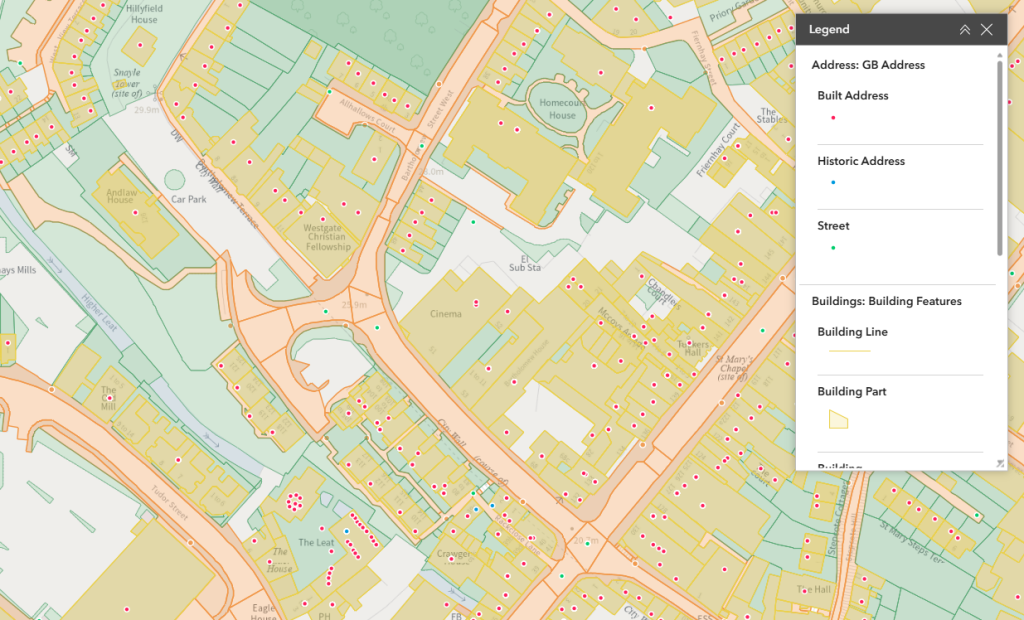
OS NGD data has been enriched with attribution to ensure that it’s straightforward to navigate and query. Attribute names have also been simplified to make them easier to understand. The Address data provides the most comprehensive and up-to-date address data for Great Britain. They offer precise location information including unique property reference numbers (UPRN), enabling accurate address matching, spatial analysis, efficient data management and an enabler for integration between systems.

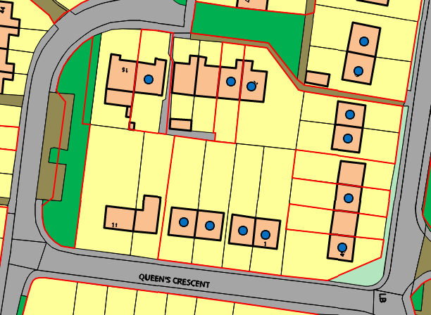
These are extremely important as they identify clearly what land you own and therefore have responsibility for in the eyes of the law. Data is licensed on an annual basis.
When purchasing Land Registry boundaries it is also possible to supply all adjoining Land Registry polygons to help identify neighbouring housing associations and organisations. 
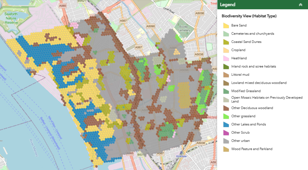
As the pressure mounts from legal and corporate bases to initiate methods of preserving and improving biodiversity, a tool is required to screen and inform decision-makers for protection and restoration.
BiodiversityView delivers a GIS data layer mapping over 40 habitats and their condition across England, Scotland, and Wales.
Identification of habitat types and their distinctiveness, mapped with 50m hexagons.
Condition scoring from satellite derived indices and verified through seasonal ground truthing by ecologists.
A tool for early-stage planning to conform with mandatory BNG and the offsite biodiversity unit market.
![]()
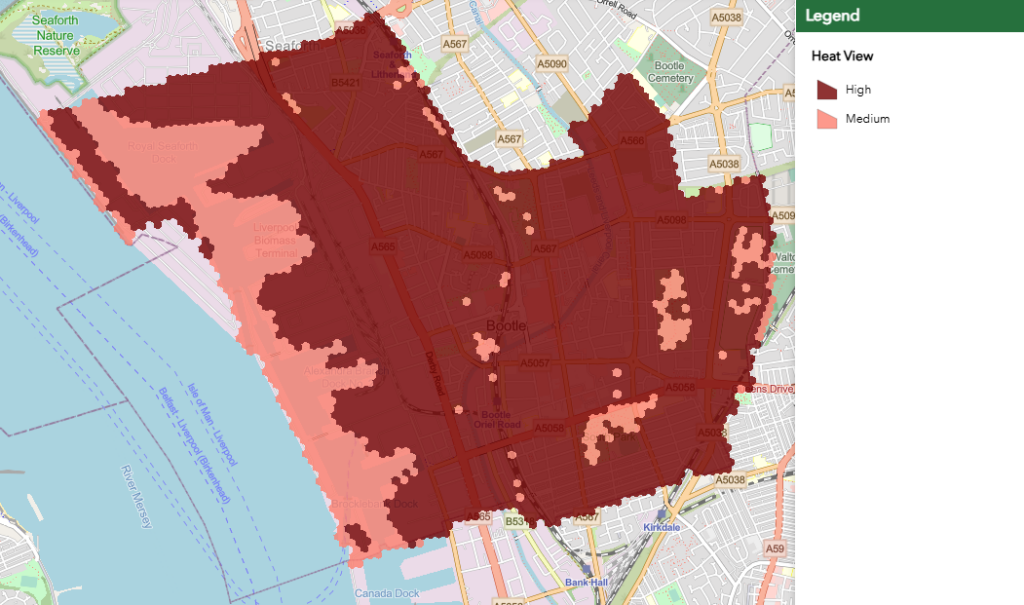
Climate change is increasingly impacting the built environment due to the Urban Heat Island (UHI) effect. Identifying and mitigating at-risk areas is now a becoming a necessity.
HeatView delivers a location-based analysis of trends relating to climatic risk over the last three years (2021, 2022, 2023).
Patterns of heat stress data can be analysed on a location-by-location basis to determine the risk to housing and human health using Land Surface Temperature (LST), while also taking into account nighttime radiative warming.
A method for accessing historical data to identify patterns related to climatic heat stress, prioritise urban planning, and implement mitigation strategies.
![]()
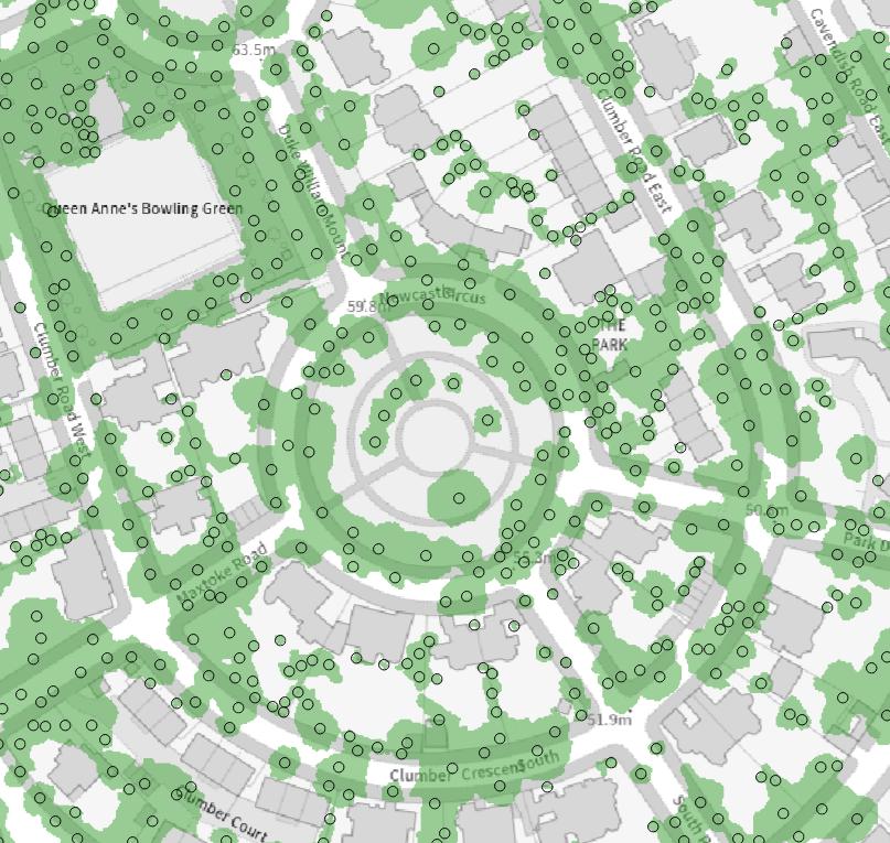
The Bluesky National Tree Map (NTM) is a unique dataset covering trees 3m+ tall across Great Britain and Ireland. Using aerial photography and other data, it maps tree height, location, and canopy size in all environments.
Regularly updated, the NTM aids environmental monitoring, carbon assessment, and targeted tree planting.
It’s crucial for achieving Biodiversity Net Gain (BNG) and is used by various sectors, including housing associations, and can be combined with hedgerow data for comprehensive vegetation analysis.
![]()
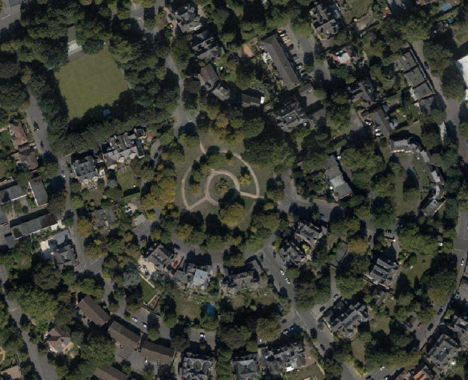
High-resolution aerial photography is crucial for numerous fields, from environmental management to planning and network analysis, and is widely used in online mapping and media.
Bluesky offers accurate, up-to-date, Ordnance Survey-accredited orthophotos covering all of Great Britain.
Using advanced technology, Bluesky specialises in acquiring and processing aerial imagery, ensuring top-quality products. The constantly updated national catalogue provides unparalleled currency.
![]()
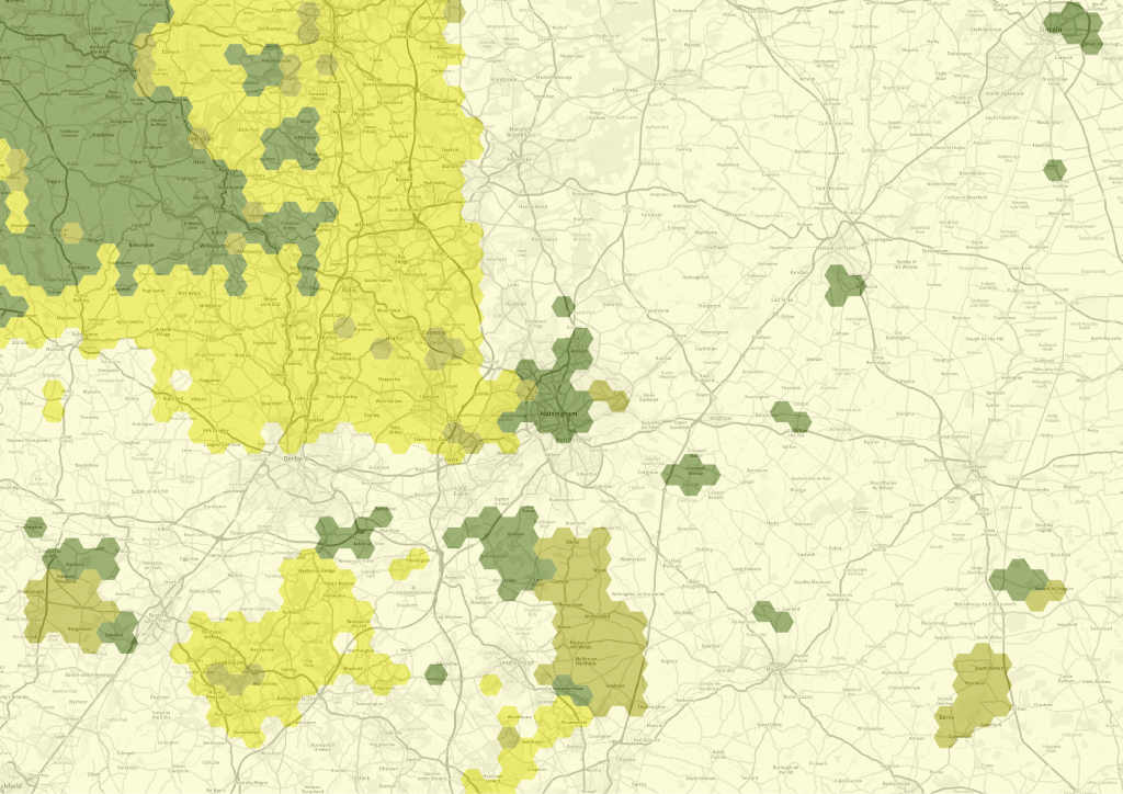
The British Geological Survey (BGS) is a data-rich organisation with thousands of datasets in its care, including environmental monitoring data, geotechnical data, digital databases, physical collections (borehole core, rocks, minerals and fossils), records and archives.
BGS’ Radon Data will allow you to check very quickly which of your properties are susceptible to Radon and the level of risk. Geosure is a particularly important dataset in assessing the risk of subsidence to your properties. Enquire now for more information.
![]()