
Ordnance Survey Addressbase

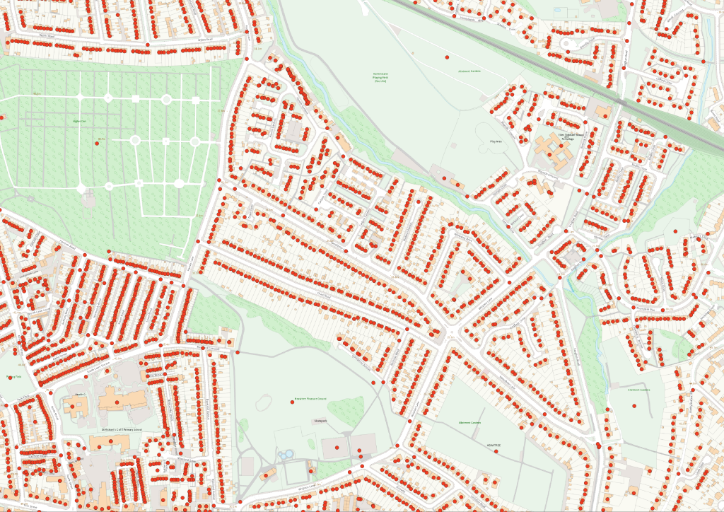
AddressBase combines local authority address information, Ordnance Survey location intelligence and national Unique Property Reference Numbers (UPRNs) to create a comprehensive view of every addressable location across Great Britain.

At a glance

  • Coverage – Great Britain
  • Formats – GML, CSV, Geopackage and PostGIS
  • Updates – Typically refreshed every six weeks; frequency can be flexible to client requirements

Key benefits

  • Proactive asset management– By using data on a properties age, construction material and basement presence, associations can move from costly reactive repairs to a predictive maintenance model.
  • Improve Data Quality – Link Customer Relationship Management Systems, Risk Registers, GIS, Asset Management Systems and reporting systems using UPRNs.
  • Support regulatory and compliance activities – Improve confidence in property, customer and location based reporting.
  • Automatic Data Updates – Through the use of a GIS Managed service, the data update are automatically applied to clients data, where not used through a PostGIS database.

Example use cases from existing clients

Property and asset management

  • Definitive Property Identification – AddressBase Premium provides a Unique Property Reference Number (UPRN) for every addressable location in Great Britain. This UPRN is a persistent identifier that remains constant throughout a property’s lifecycle (from planning to demolition), allowing housing associations to create a single, definitive view of each asset.
  • Linking Disparate Data – The UPRN acts as a crucial link, enabling housing associations to connect their internal property data (e.g., tenant details, maintenance history, energy performance certificates (EPCs), compliance records, building materials, construction age) with a precise geographic location. This creates a powerful, integrated dataset for comprehensive asset management.
  • Risk Assessment – The data enables detailed risk analysis at the individual address level, for example, assessing flood risk or proximity to hazards.
  •  

Insurance, lending and risk

  • Policy and Property Matching – Link insurance policies to a precise property location using UPRNs to improve data quality and reduce duplicate records
  • Claims Management – Verify insured locations and match claims to the correct property record, helping streamline validation process.
  • Customer Insight and Segmentation – Enrich policyholder records with geographic intelligence to support pricing and product development strategies.
  • ESG and Climate Risk Reporting – Identify assets exposed to environmental risks and support regulatory requirements across loan portfolios.
  • Customer Data Management – Improve customer onboarding and data quality by using a trusted national address dataset.
  • Property Valuation Workflows – Improve the matching and consistency of valuation data across multiple systems and data sources.


ODCGIS supports organisations by capturing and validating property points against Ordnance Survey AddressBase, assigning accurate geospatial locations and linking each asset to its Unique Property Reference Number (UPRN). This creates a trusted foundation for integrating property, asset, compliance and operational data within a GIS.

Want to see what Ordnance Survey Addressbase can do for your organisation?

Talk to our team about the OS Addressbase data, formats and licensing or request a quote.