
Ordnance Survey Mastermap Topography Layer

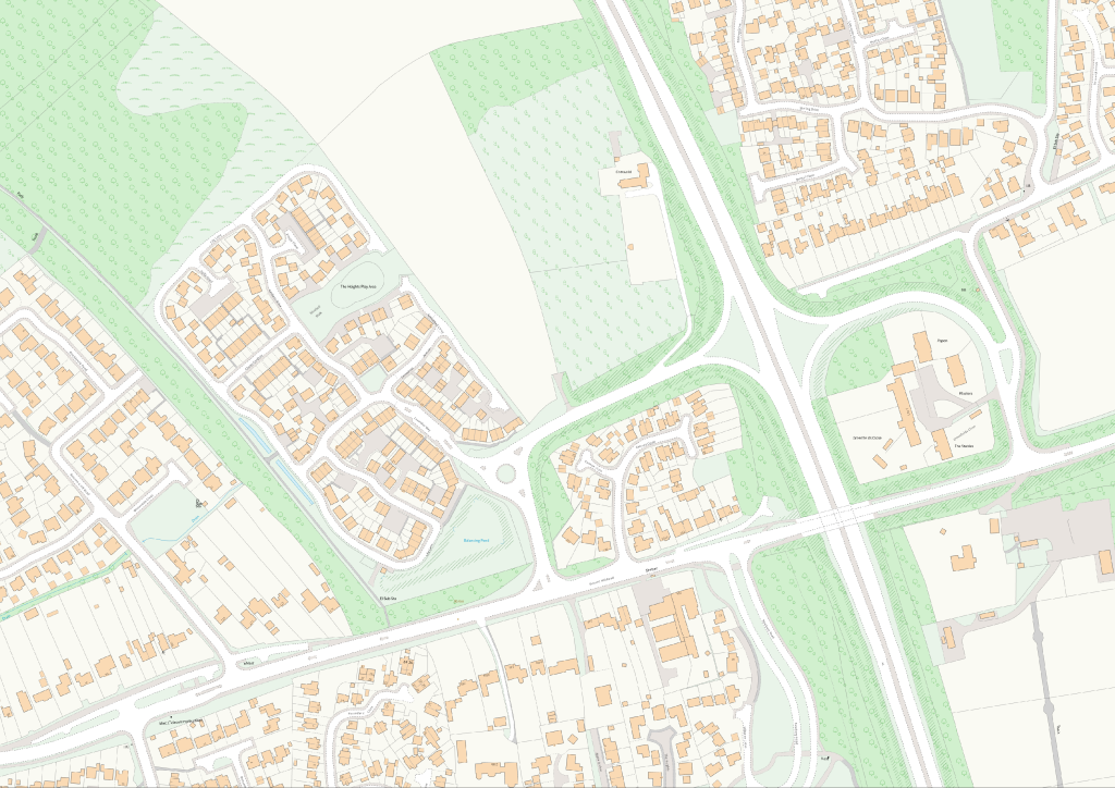
Ordnance Survey MasterMap (OS MasterMap) Topography Layer is Britain’s most detailed and definitive large-scale mapping dataset, providing detailed information on buildings, roads, paths, land parcels, vegetation, water features and other physical assets. It forms the foundation of many GIS, asset management and location intelligence platforms.
At a glance

  • Coverage – Great Britain
  • Formats – GML, Shapefile, GeoPackage and PostGIS
  • Updates – Typically refreshed every six weeks; frequency can be flexible to client requirements


Key benefits

  • Trusted location data – A reliable geographic view of your assets, customers, infrastructure and operations.
  • Better decisions – See the physical environment around properties, facilities and investments to improve location-based decision-making.
  • Stronger planning – Support strategic planning with analysis, visualisation and modelling built on accurate geographic data.
  • Greater efficiency – Give teams consistent mapping across business systems and workflows.
  • Automatic Data Updates – Through the use of a GIS Managed service, the data update are automatically applied to clients data, where not used through a PostGIS database.

Example use cases from existing clients


Property and asset management

  • Accurate Property Identification – Combined with AddressBase and Unique Property Reference Numbers (UPRN), OS MasterMap gives precise locations for every property. Organisations can identify assets accurately, link them to internal data (e.g. Energy Performance Certificate (EPC) ratings, ownership and construction records) and streamline maintenance schedules.
  • Visualising Property Portfolio – View the entire property portfolio on a detailed map, with each building in context. This supports planning repairs, identifying properties needing intervention (e.g. energy-efficiency retrofits) and optimising maintenance routes.
  • Grounds Maintenance – Mapped features such as trees, paths and land parcels help plan and monitor grounds maintenance around properties.


Insurance, lending and risk

  • Catastrophe Risk Modelling – Understand geographic concentrations of insured assets to improve flood, storm, wildfire and other catastrophe exposure modelling.
  • Property Underwriting – Give underwriters detailed location context for more accurate risk evaluation and pricing.
  • Claims Validation – Verify property locations and surrounding features for faster, more accurate claims investigations.
  • Mortgage Portfolio Analysis – Visualise lending exposure geographically to understand concentration and location-based risk.
  • ESG and Climate Reporting – Assess environmental and climate risks across investment and lending portfolios.
  • Operational Resilience – Understand risks to branches, offices and critical facilities to support business continuity and planning.

Want to see what Ordnance Survey Mastermap can do for your organisation?

Talk to our team about the OS Mastermap Topography Layer data, formats and licensing or request a quote.