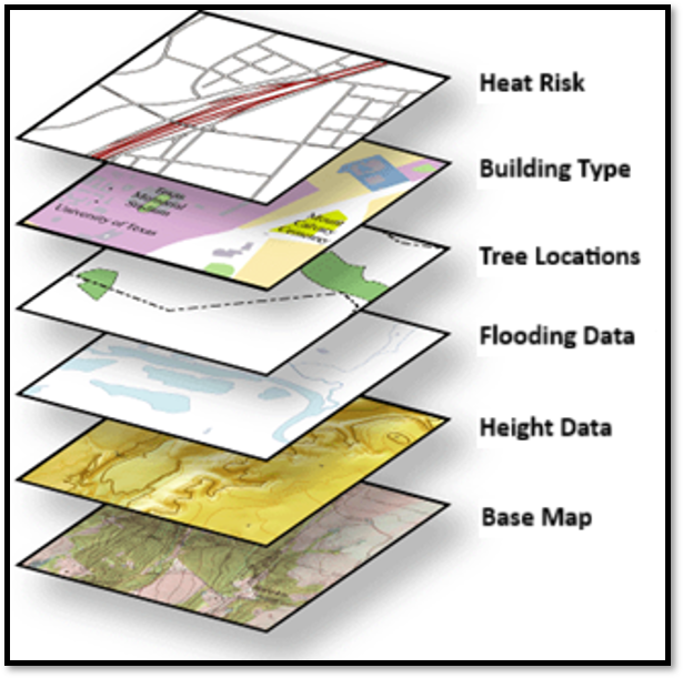
ODCGIS Property Insights is a strategic resource designed to not only fill in some of those data gaps but to also provide further insight by combining the most accurate and up-to-date national base datasets with ODCGIS analytics.
The aim is to equip users, who need no GIS knowledge or skills, with a simple, readily accessible way to analyse the condition and spatial context of assets, make decisions on repairs, maintenance and investments, assess flood, subsidence, radon and other insurance risks and optimise contractor management.
Each of your properties will be attributed with data from the following suppliers and then analysed by ODCGIS Officers to give you the required information and provided in either an Excel spreadsheet so the data can be utilised within your other business systems or as GIS Files if you already have a GIS System.
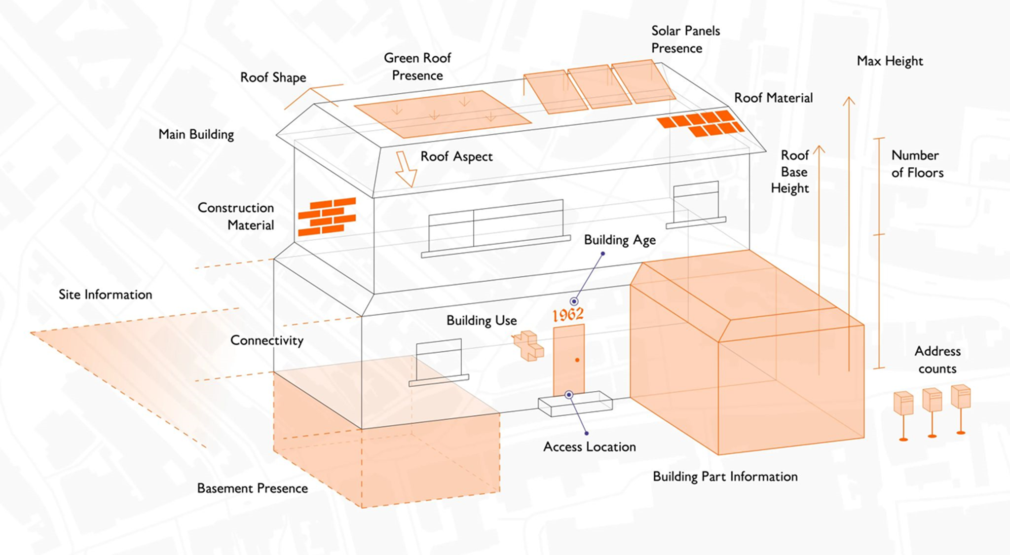
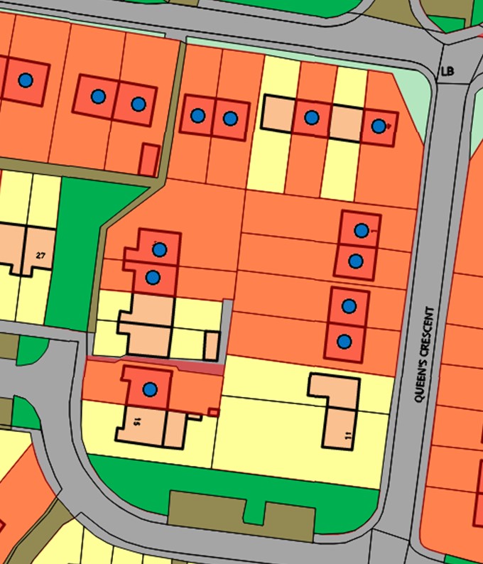
Ordnance Survey NGD
Ordnance Survey NGD is a single store of all Ordnance Survey’s authoritative data for Great Britain. The OS NGD delivers the richer data you need for better analysis and includes- Building Heights, Number of Floors, Construction Type, Build Year, Roof Type, Solar Presence, Basement Presence.
Twinn by Haskoning
Twinn by Haskoning supply accurate Climate Data, evaluating the risk of Flooding. Used by Insurance Companies and Banks across the UK analysing this data against your stock will allow you to see which of your assets are most at risk of flooding now and in the future. Helping you to plan and prepare rather than acting reactively.
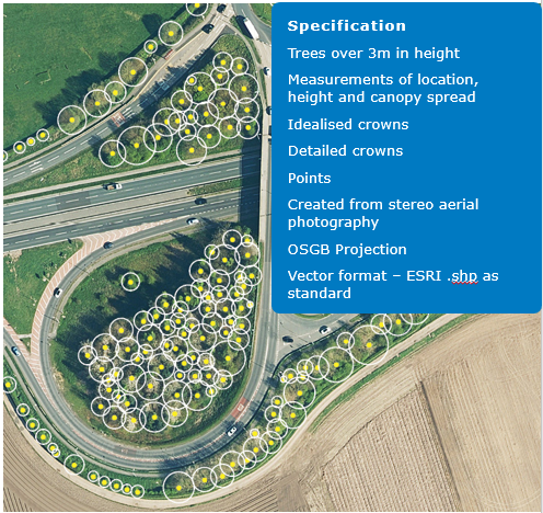
Bluesky
Provides the location of all trees over 3m in height as well as their canopy spread and potential height giving you a starting point for any tree surveying. As part of the property insights offering ODCGIS Officers will also analyse the location of these against your assets to see where assets maybe at risk from trees either being in close proximity or canopys that cause issues for damp and mould etc
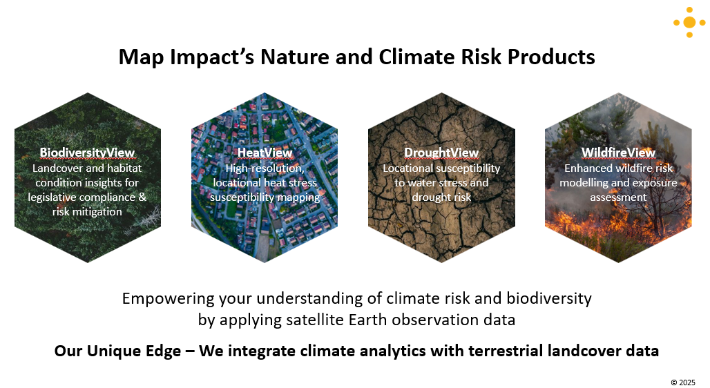
Map Impact
Map ImpactProvides a range of products all included within the Property insights package, highligting not only the risk of excessive heat on your properties due to the environment around them but also the levels of Biodiversity along with the risk of Wildfire & Drought.
Land Registry
HMLR Land Registry boundaries are extremely important as they identify clearly what land you own and therefore have responsibility for in the eyes of the law.
British Geological Survey (BGS)
British Geological Survey (BGS) is the UK’s premier provider of geological data and research, it serves as a key resource for government, academia and industry, providing impartial advice and data on geological matters. Their Radon data is of particular interest identifying properties at risk from this radioactive gas.
Open Data
Open data can come from any source, often from Local or Central Government or from bodies such as the Office of National Statistics, Health Boards etc. Just a few examples includes data such as Indices of Multiple Deprivation ranks, Political Boundary Information, Subsistence Risk, Coal Mining Area’s, Conservation Area’s, proximity to fire stations & hospitals, Gas & Water Lines and much more.
Get in touch
If you’d like to know more about ODCGIS Property Insights get in touch.
In the video below, Rick explains the rationale behind ODCGIS Property Insights and how it will help a housing association.
Data matters and can help you meet your responsibilities with Awaab’s Law, identify some of the causes of Damp & Mould and achieve your Net Zero Carbon targets. For example, Radon Gas can be associated with the Housing Act 2004 and Awaab’s Law as a hazard, and a housing association can face fines if it’s found to be failing in its Radon Gas responsibilities.
The government are looking at bringing in new standards (UK Sustainability Reporting Standards) about climate risk management, biodiversity and carbon reporting. Can you demonstrate to potential investors and other stakeholders what you’re doing to mitigate climate risk?