Have you invested in a GIS? Created databases and then your GIS Officer has left and has never been replaced? Maybe one of your officers ‘looks after it’ when they have some spare time?
It’s important to have someone dedicated to look after your GIS, maintaining currency of the data, fulfilling tasks when required and ensuring the GIS doesn’t stay stagnant and develops with future projects.
Here are just two of a number of examples where this happened and the housing association turned to ODCGIS to protect their ROI and get the most from their GIS.

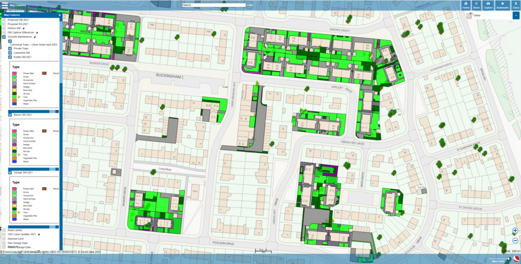
One Vision Housing have employed a number of GIS Officers over the years utilising their Cadcorp GIS. Looking to recruit a new GIS Officer, it was apparent that there is a lack of GIS skilled professionals with an in-depth knowledge of Social Housing to be able to hit the ground running. ODCGIS offer unrivalled experience in GIS mapping for the social housing industry and so, in December 2019, One Vision decided to take on ODC’s GIS Managed Service.
ODCGIS officers act like they are One Vision’s GIS Officer. Acting timely with GIS requests as well as updating Grounds Maintenance layers, property data as well as performing other GIS tasks such as creating Sales Plans. ODCGIS have remote access to One Vision’s Cadcorp systems and servers and carry out everything that is required.
ODC’s GIS Managed Service means One Vision always have a GIS Officer they can contact to perform a task, saving them time and money, benefitting from ODC’s expertise in getting the most from GIS. Going forwards, One Vision’s investment in GIS is taken forward and developed so the organisation can get even greater usage out of it!
“We have been delighted with ODC’s Managed Service, having a GIS Officer available whenever we need one is a cost-effective way to run our GIS and allows me to get on with my ‘normal’ job. Not only that but tasks are carried out in a fraction of the time they used to take”
Jessica Shaw —Asset Data & Planning Manager
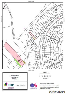
This second example is from CHP who have ESRI Enterprise and ArcGIS Online.
Essex based CHP faced a similar problem when their GIS Officer left the company. Should they consider the option of using ODCGIS’s GIS Managed Service? Finding a GIS Officer with experience of social housing can be a difficult task. ODCGIS have a team of GIS Officers available throughout the year to be called on only when required. ODCGIS’s expertise means they fulfil tasks efficiently and at significantly less cost.
ODCGIS hit the ground running covering the tasks previously done by CHP’s GIS Officer, at the same time advising on other ways the GIS could provide strategic insight for different departments. CHP initially took out a Silver package as a Proof of Concept which was extended as the Managed Service proved to meet their requirements. This has just been renewed for a further two years.
“When faced with the challenge of replacing a very experienced team member, we decided that the most expedient route was to consider using a managed service. Our demand for tasks from a GIS Analyst fluctuated quite a lot and the skill was hard to find. ODC offered up a perfect solution for a realistic price. We have been very impressed with the responsiveness, quality and speed of delivery from ODC and would not hesitate to recommend them. This proved to be a wise decision, rather than a default option!”
Michael Barber – Digital and Transformation Director, Executive Management Team
GIS can be a massive benefit to housing associations, the licenses cost money so if you’re not using your GIS to its maximum then you should talk to us! Read more about ODCGIS’s unique GIS Managed Service here or contact us now! Email sales@odc.co.uk or call 01993 875153