The Asset Mapping Project (AMP) sponsored by NCALC invited parishes and town councils in Northamptonshire to map all the important community assets and services within their Parish, including those currently owned by the two new unitary authorities-West Northamptonshire (WNC) and North Northamptonshire (NNC). The plan being to build capacity in parish and town councils, develop a solid evidence base, and design an administrative framework for devolution in Northamptonshire. It is a unique and ambitious project which will enable NNC, WNC and the county’s 271 parish and town councils and parish meetings to be well prepared for any future decisions about devolution.
Parish Online is an online platform which allows councils to collate and record their mapped data including assets (land and property), services, and any assets of community value.
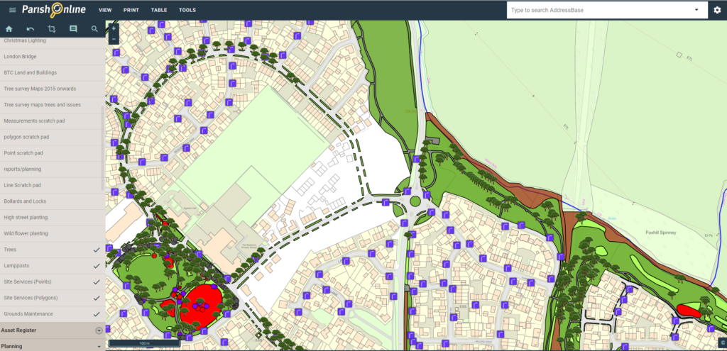
Brackley Town Council (BTC) had mapped some assets onto Parish Online but WNC assets remained unmapped and would be a time consuming exercise for its staff. Oxford Data Consultancy (ODCGIS) offer a niche data capture service specialising in the capture of grounds maintenance, open spaces and other assets and were therefore ideally placed to support BTC.
The data capture is a desk top exercise utilising Ordnance Survey Mastermap Topography & Imagery and Google Streetview along with Grounds Maintenance Plans supplied by BTC and Land Registry Boundaries which identify the land owned by BTC and WNC.
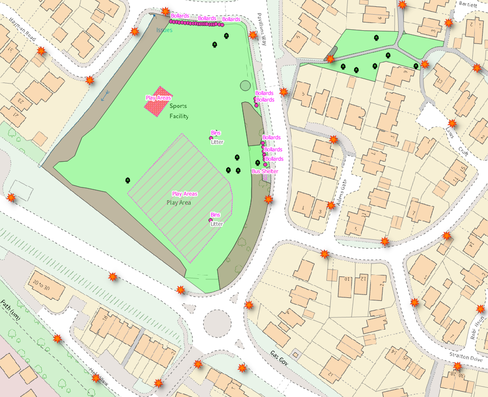
A pilot exercise was carried out prior to a meeting to discuss the process and set some rules on the anomalies that had been identified. ODCGIS then captured the grounds maintenance data contained within the LR boundaries and using the coloured plan supplied by BTC as a guide. Grass, shrub beds, hedges, hard standing, bus shelters and bins were captured along with streetlamps. New developments were supplied as coloured up plans depicting ownership.
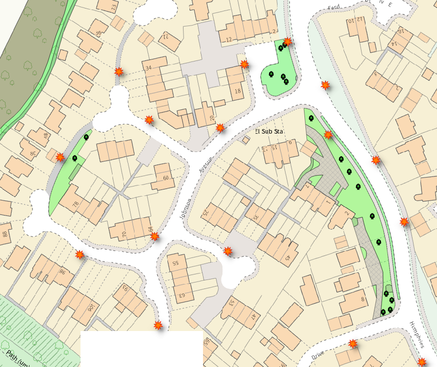
In some cases, the digital information isn’t clear (maybe hidden under a tree or in shadow) and so a detailed PDF was supplied to BTC to ask them to use their local knowledge and resolve the anomaly. These requests were resolved promptly allowing all data to be captured to a tight deadline. On approval, the completed data was loaded into Parish Online ahead of schedule and a detailed Bill of Quantities supplied.
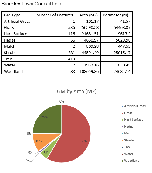
A separate Bill of Quantities was supplied for both BTC and WNC assets, each listed the number of features for each type of asset plus their area in square metres.
The data was attributed to identify BTC land (above) and WNC land (below) allowing NCALC to develop a solid evidence base and design an administrative framework for devolution in Northamptonshire.
“NCALC who were sponsoring the Asset Mapping Project set an ambitious deadline for us to supply all the information and we didn’t have the resources to complete the project inhouse within the time frame. ODC were able to complete the process to our specification and we very pleased with the result.”
Alison Moses – Town Clerk, Brackley Town Council