Are You Making The Most Of Your GIS?

Have you invested in a GIS? Created databases and then your GIS Officer has left and has never been replaced? Maybe one of your officers ‘looks after it’ when they have some spare time? It’s important to have someone dedicated to look after your GIS, maintaining currency of the data, fulfilling tasks when required and […]
Brackley Town Council Get Their Assets Mapped
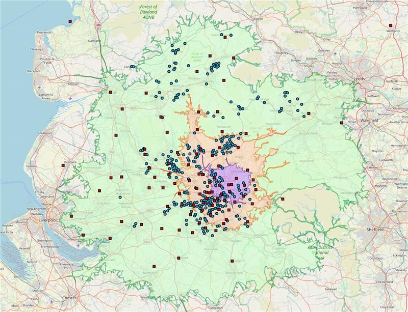
The Asset Mapping Project (AMP) sponsored by NCALC invited parishes and town councils in Northamptonshire to map all the important community assets and services within their Parish, including those currently owned by the two new unitary authorities-West Northamptonshire (WNC) and North Northamptonshire (NNC). The plan being to build capacity in parish and town councils, develop […]
Business Continuity Planning Map to Manage Home Working
When the Coronavirus outbreak first started, it was clear that contingency plans should be put in place in the event of home working. This included mapping drive time areas from staff postcodes to assist with business planning. ODC offered to help any social housing provider get a quick overview and allow them to make decisions […]
THT Web GM Maps for Tenants
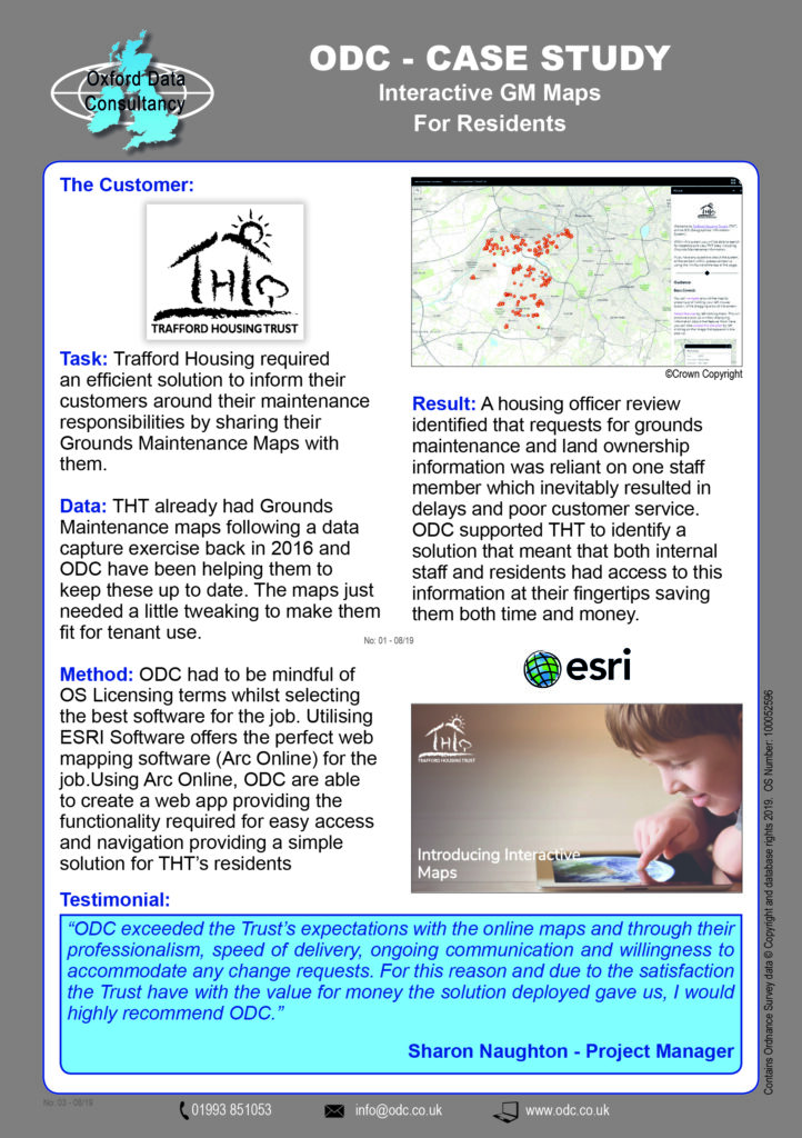
ODC have recieved a great testimonial for providing a solution to Trafford Housing Trust using ESRI’s ARC Online product to deliver Grounds Maintenance ownership plans to THT Tenants: ‘Following a housing officer review, the trust identified that requests for grounds maintenance and land ownership was reliant on one staff member provisioning this information, which inevitably […]
Asset Data Capture Well Underway in Stockport
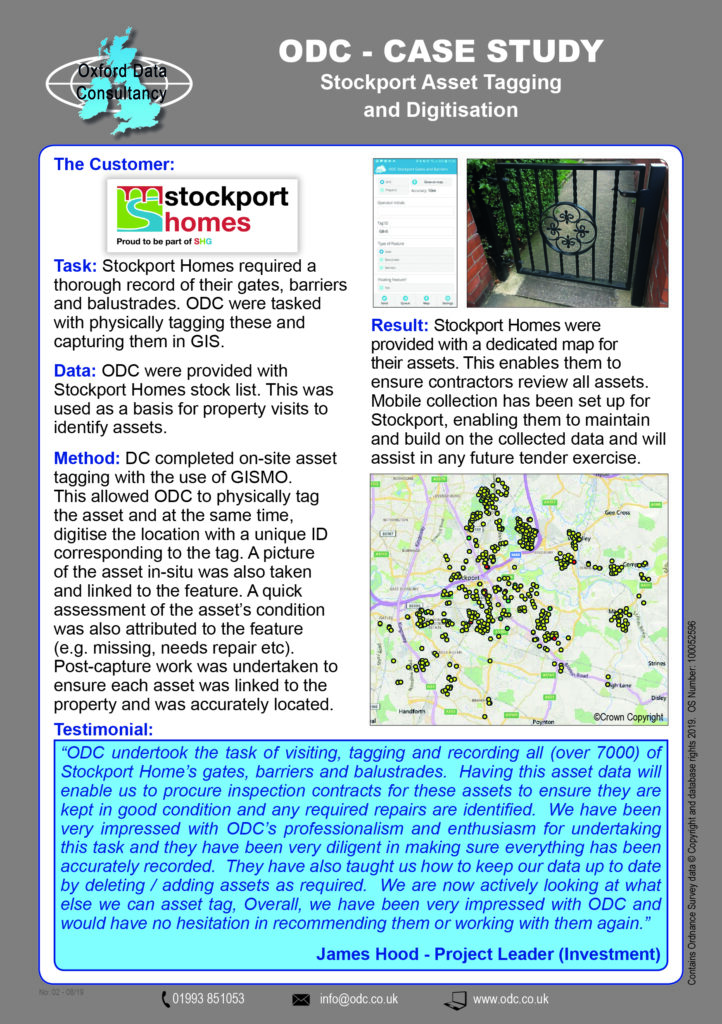
Stockport Homes are one of our latest data capture projects which involves tagging Stockport Housings assets-things like barriers, balustrades and gates. In the first week on-site we completed 2,324 properties, fully processed including photos tagged and linked to the feature. At the end of this project Stockport Homes will end up with all their Gates, […]
New Grounds Maintenance Data Capture Case Study- NPH
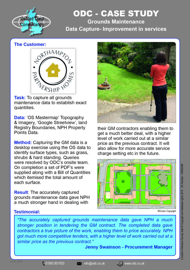
Holding your grounds maintenance data in a GIS (Geographical Information System) means you have an accurate record of surface types which you can pass to your GM Contractors helping them give you an accurate price. Moving from just having records on paper plans with a guesstimate of how much grass there is to cut to […]
Radon Analysis- Walsall Housing Group
Radon Gas, have you checked your properties against the risks of this radioactive gas? As part of their Managed Service, we completed a radon analysis for Walsall Housing Group using GIS data.